Topographical Maps are an important aspect for any engineering project. They can be used to gain a better understanding of the terrain. They also prove beneficial while estimating and evaluating the terrain, where the work is to be executed.
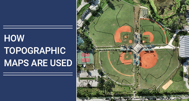
A topographic Map is your 3D model that helps you understand changes in elevation by contours. It is not limited to showing land formations but also displays all man-made features like roads, electric poles, buildings, etc.
In topographic maps, it is possible to see the topography of a specific land area or the shape of its land surface based on the map. A topographic map shows where hills and valleys are located, where streams flow, where other natural features are found, and where many man-made landmarks are located.
About Topographic maps
It is typical for topographic maps to display the shape of the Earth’s surface by using elevation contour lines. An elevation contour connects points on the earth’s surface with the same elevation on both sides of a reference surface.
This generally means sea level above or below this surface at the same height. With contour maps, you can see the heights and contours of mountains, the depth of the ocean floor, and the slope steepness in the form of contour charts.
Besides showing topographic maps, USGS topographic maps also show a wide range of other geographical features, including roads, railroads, rivers, streams, lakes, boundaries, place names, mountain ranges, and many other geographic features.
Importance of Topographic Maps?
Most of the projects start with groundbreaking or land clearing. This process continues to include underground utility installation. Then fill dirt is imported to bring the site to a level condition above the base floodplain.
Accurate and measured topographical data can help engineers and contractors understand and buy the right amount of fill dirt and have an accurate plan for laying out utilities.
There are other uses of Topographical Maps in various other fields which you will learn from this blog.
Contour Lines
A topo map shows elevation by connecting points of equal elevation with contour lines. If you imagine walking around a mountain in a circle at the same altitude going up and down, navigating the mountain by walking in a circle, it would help you visualize elevation changes.
In the case of a map, you would draw a contour line as a result of tracing the path you walked. A contour line is usually separated by a horizontal distance of 40 feet from a contour line. It is essential to verify whether your map has contour lines separated by 40 feet. Every fifth contour line usually has an actual elevation on it.
USGS Maps
The U.S. Geological Survey created topographic maps of the entire country after surveying land in 1879. As a result, over 54,000 topographic maps have been created by the USGS, which lay the foundation for most commercial topographic maps today.
Besides highways and dirt roads you would find on regular road maps, USGS topo maps also show you the cities, towns, and other structures you would find on standard road maps.
You can also find power lines, rivers, glaciers, and mines on the maps. The map also shares some information about power lines.
Land Features
In a particular area, the contour lines can provide a clear picture of the shape of the landforms. In the case of concentric circles, for example, the smallest circle signifies the summit, while the most extensive circle represents the peak.
A landscape filled with contour lines that are close together indicates that the land is very steep, while a landscape filled with contour lines that are widely separated indicates that the land is relatively flat.
An encircled saddle or gap between two peaks — or two sets of concentric circles — can be characterized by contours that enclose the two peaks or two sets of concentric circles.
Use of topographic maps
Professionals in various fields use topographic maps for multiple reasons, from construction workers to geologists. In all of them, topographic maps are used to analyze the surface of the earth. The following are some of the uses for topographic maps.
Construction Surveying
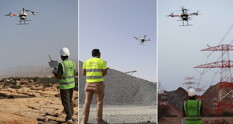
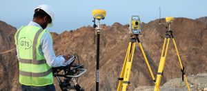
The construction industry frequently uses topographic maps to assist in planning their projects. With the help of a topographic map, designers can make adjustments according to changes in elevation and terrain when planning a project. Accurate data is a crucial factor to avoid over budget, Knowledge of the land’s slope is crucial to designers so they can prepare for excavation according to the slope of the land and ensure that watersheds are adequately managed.
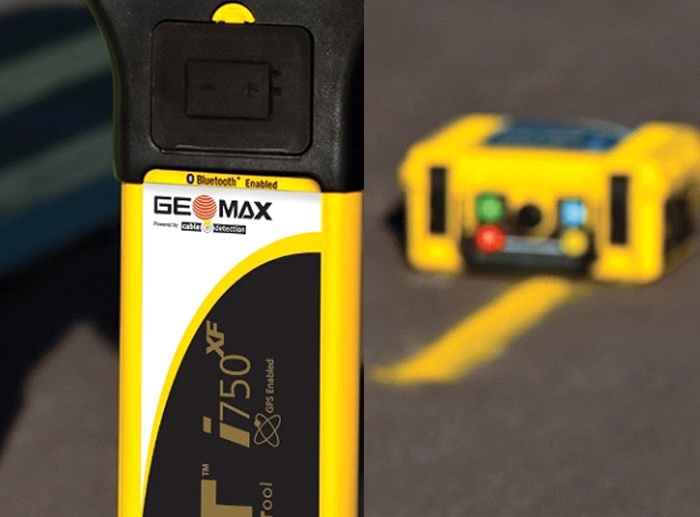
Since topographic maps also show existing roads, pipelines, and power transmission lines, topographic maps are also used to plan infrastructure projects. By using these maps, it is possible to ensure that power, water, and access to existing roads are all set up in the new building.
Resource Management
Various industries can benefit from topographic maps for resource management. Using topographic maps, the mining industry tracks inventory and calculates asset turnover ratios.
Topographic maps are used in construction industries to track stockpile inventories. Businesses need to keep track of their valuable materials not only for loss prevention purposes but also so they can determine when and how much to order.
Maritime
The Topographical Map generated by the Bathymetrical survey is beneficial for the Port and Maritime Project. It provides geospatial data on coastal lines and shallow waters. It also helps you understand the depth of the seabed along with the land area.
Mineral Exploration
Magnetic anomaly Map generated by conducting a magnetic survey with an advanced Magnetometer sensor plays an important role in the modern age of mineral exploration. It helps clients locate potential mineral deposits quickly and saves on exploration time and cost.
Mining & Quarry
A topographic map of the Project area or mining sector will be beneficial for Stockpile measurement. The availability of accurate data will prove essential in understanding and cross-checking the forecast with the delivery. It will also give a clear idea of the amount that needs to be produced to meet the demand. Furthermore, Topographic Maps and stockpile Volume computation allow tracking of how much is escalated in a targeted time.
Soil Conservation
Maps of the earth’s topography are handy for tracking changes in the earth’s surface. Because these maps reflect any issues with erosion and tile drainage, they can be used to show a land’s impact on agriculture.
Recreation
Topographic maps are helpful for adventurous people who enjoy the outdoors, particularly when exploring regions with uncertain terrains. People of all types can use a topographic map, including hunters, hikers, climbers, skiers, and more. Knowing the elevation and terrain of the places they’re going to explore is, of course, a good idea.
Military
Throughout history, the military has used topographic maps extensively. Military strategies are developed by analyzing detailed information on the maps, including information on the elevation, hills, mountains, and bodies of water, all used to create military strategies. Soldiers need to be prepared and equipped appropriately based on the terrain they will be operating in if they want to be successful.
Weather
Furthermore, the way land features are formed, such as canyons and plateaus, has a significant impact on climate and weather. An area near a lake will receive more snow during a winter storm because of the lake effect caused by a narrow canyon.
Weather can be predicted more accurately using topographic maps.
A topographic map is a common tool used by meteorologists to analyse how weather, pressure, and temperature affect large areas of land.
Conclusion
Topographic maps are used in a wide variety of fields. Whenever there is a need to know how the earth and its terrain relate to a project or activity, topographic maps prove helpful, as they provide very detailed representations of the topography of the area where you work. Get in touch to learn more about topographic maps and other tools crucial for the optimal working of the surveying industry.
Read More: https://gulftestinglab.com/topographical-survey-and-importance-of-topographical-surveys/

