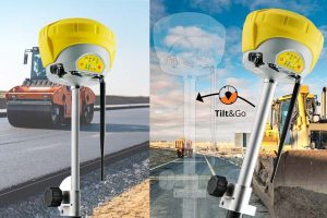
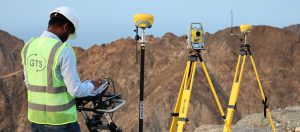
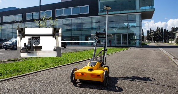
Over the decades, land surveys have drastically changed from ancient measuring ropes, Total stations, and GNSS, we have advanced to performing Aerial Survey with the help of UAVs.
One of the major challenges achieved by drone innovation is the collection of geomatics (Land Study) data on landforms. Before drones came into the picture, the task was limited by the technology at the time.
However, collecting this data through aerial surveys has made information gathering easier and more accurate. Drones or other forms of UAVs (Unmanned Aerial Vehicles) are widely deployed for this purpose due to their relative ease to use.
Drones have been around for a while. In fact, the technology has now been widely used in surveying and remote sensing. Technological advancement has afforded us tech such as affordable drone technology, lightweight lithium polymer batteries, cutting-edge close-range oblique aerial photography, and lightweight LiDAR sensors & digital cameras. Together, these make the future of drones a very thrilling prospect.
Aerial Survey has changed drastically from ancient measuring ropes, total station, and GPS to advanced UAVs.
About Aerial Surveys:
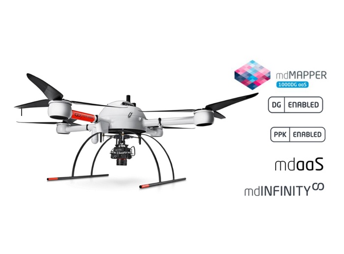
Aerial surveys involve using unmanned aerial vehicles or drones with sensors on the bottom, such as LIDAR, Magnetometer or RGB cameras that can capture data from the air. Aerial drone surveys measure the ground from different angles several times. A picture’s coordinates are always recorded, so you can always determine where it was taken.
The term drone can refer to either a UAV (Unmanned Aerial Vehicle) or a UAS (Unmanned Aerial System).
A drone is made with cameras and sensors built in and attachable to it. Certain global drone manufacturers continue to support some drone models with their sensors to support the manufacturers who develop sensors and payloads that can be attached to these drones and used in various industries.
For this purpose, an RGB sensor can be used to satisfy the surveyor’s growing requirements. The drones are usually controlled with a Smart Remote Controller; this remote controller helps the surveyor operate the drone and record accurate point clouds and capture images.
Benefits of Aerial Surveys for businesses
To achieve success, it is essential to plan every aspect of a large-scale commercial project down to the last detail. Accurate data cannot be overstated to avoid overspending or significant setbacks.
Large-scale commercial projects can be improved with an accurate and complete aerial survey. Drones used in aerial surveys have many advantages in commercial projects.
Besides offering advantages at the beginning, they also serve as significant assets throughout the project.
1. Ensure accurate and efficient surveying to reduce costs:
It will cost you more upfront to conduct large-scale accurate surveys, but it is more cost-effective in the long run. Compared with manned aerial surveys with helicopters and aircraft, unmanned aerial surveys are more affordable in the early stages of surveying.
By conducting accurate surveys, you will save time and money by preventing reworks and issues throughout the commercial project.
Roadblocks can also be avoided during construction using unmanned aerial surveys to collect accurate data. Since surveying takes place at the beginning of a project, a delay could delay its completion.
2. Rapidly cover large areas:
By using advanced software solutions, surveying data can be simulated and modeled. With these models, we can plan a project, repair it, and renovate it. Maintenance is an integral part of large-scale commercial construction projects.These data can be used by construction companies to plan well for future renovations and maintenance and to predict when repairs will be needed.
3. Covers most regions from overgrown lots to commercial areas:
Disrepair-stricken lots, commercial areas, and industrial areas can be complex. Aerial surveys can be performed anywhere using UAVs to generate accurate and high-quality images.
The ability of UAVs to map the ground even when it’s not visible and to use advanced aerial survey technologies, such as LiDAR, makes them a better alternative to manned vehicles.
Since LiDAR sensors can account for both elevation and vegetation, they provide absolute accuracy in creating realistic bare earth models.
Having hundreds of sensors emitting points per square meter, LiDAR’s high data point density allows surveyors to create highly accurate data.
LiDAR is short for light detection and ranging. A light pulse is released towards the target, and time is measured as it bounces back.
It lets you make digital elevation models that are only possible with Aerial Photogrammetry Software.
Unlike other technologies, LiDAR can produce DEMs and DTMs, so it’s perfect for meeting various challenges.
Commercial projects require high-resolution information, which can’t be acquired on foot or manned scanning – at least not without considerable financial and personal risk. UAVs are the best way of surveying commercial projects requiring accuracy and complexity.
4. Safeguarding health & safety:
With drones, data can be collected in compromised, hazardous, or sensitive environments, with minimum risk to surveying professionals and the general public. It is easy to capture data from the air, with no health or safety risks.
Consequently, planning time and health and safety considerations are reduced, resulting in a faster project turnaround.
5. Reduced costs:
Traditional survey methods require enormous funds for every survey operation, and a firm’s operations are challenging due to the heavy costs incurred.
With photogrammetry and drone technology, companies can reduce the enormous expenses incurred during plot surveying by applying photogrammetry in modern-day surveys.
Industries that Benefit from Aerial Surveys
Many industries in the business sector have benefited from aerial surveys to achieve high-quality photos for marketing and other purposes.
Let’s get to know more about it.
1. Cartography and Land Surveys:
With aerial surveys, you can generate highly detailed 3D models and high-resolution images of areas with outdated or poor-quality data. Additionally, drones can generate cadastral maps in complex environments more quickly and easily. Building and land sites can also be reconstructed in 3D with high-quality details.
2. Urban Planning:
Traditionally, surveying dense urban environments is expensive and time-consuming. It is also possible for urban planners to use drones to gain a vast amount of data by using fewer personnel and in a more efficient manner.
A drone image can provide planners with information about locations’ environmental and social conditions that can be used to consider the effects of various changes. With the help of 3D models, they can overlay buildings within their environment.
As the project progresses, a progress report could be created for building homes and buildings. For marketing purposes, virtual tours can later be captured for home marketing.
3. Land Development:
Land planners and managers can make aerial photographs and land topographic surveys more quickly using drones. The software can assist with designing and planning allotments, scouting sites, and constructing buildings, roads, and utilities.
These detailed models will help support site topography as part of the pre-construction engineering studies. Drone-based aerial surveys are very cost-effective and can be repeated if needed.
4. Oil & Gas:
As the best commercial drone for surveying, the drone is used in oil and gas surveys. A drone survey assists oil and gas companies to determine where pipelines can and cannot be laid because pipeline installations require meticulous planning.
The placement of pipelines is influenced by natural resources, conservation sites, infrastructure already in place, and private property ownership. Using drone data, out-of-bounds areas can be quickly identified.
5. Roads and Infrastructures:
The Aerial Corridor survey technique is adequately more suitable for pre-construction planning and existing infrastructure monitoring for road projects, overhead power lines, and oil and gas pipelines. It also covers existing infrastructure monitoring delivering precision surveys across short or long corridor areas, using advanced drones and sensors with centimeter accuracy. It also includes rapid surveying and inspection of road projects, overhead power lines, oil and gas pipelines, and existing infrastructure monitoring.
6. Mining Industry:
In the mining industry, drones are employed to provide clear and precise quarry site conditions.
Mining and quarry companies can benefit immensely by using technology, specifically drone technology, to perform stockpile management & Inventory Control, Haul Road Optimization, and Regular Monitoring of Tailing Dams. The data collected by drones is more accurate,
more reliable, faster, and more efficient than traditional methods. Mining operations can also benefit from using drones. Since mining is a dangerous industry that claims many lives and thousands of injuries a year. The use of drones in mining will help improve the safety of workers and eliminate unnecessary risks to their well-being. From initial exploration to capturing surveying data for pre-blast and post-blast analysis, drones allow their operators to avoid hazardous situations and keep themselves and their fellow colleagues from any harm whilst still maintaining the highest standard of work.
Drones are the future for mining, and quarry companies that want to be successful.
Conclusion
Based on the facts observed in this guide, Aerial surveying has a great future filled with unlimited successes. Accurate and efficient aerial imaging benefits many industries, enhancing profitability and productivity. Global economies will be impacted by the rise of Aerial surveying services commercially and privately.
Have we convinced you about the importance of Aerial surveys? Then take the first step, and get in touch with us and we’ll help you find the right Aerial Survey Services for you!

