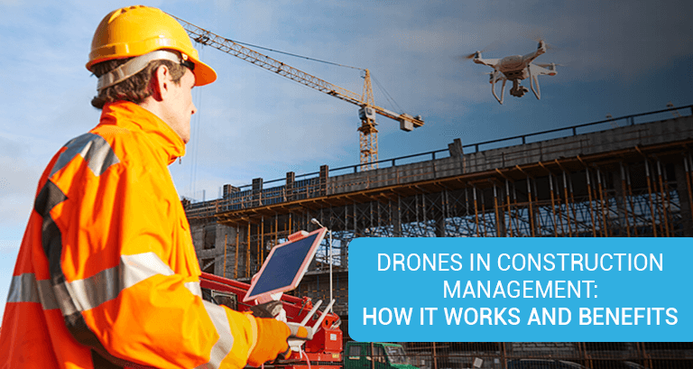
Technological innovation has come to the rescue of professionals in the construction industry to address common challenges involving time and cost overruns. There were times when each task at extensive project sites was done manually. Today, however, manual labour is replaced by advanced technology such as robots, machine control, telematics, and drones. These tools have ensured maximum efficiency while reducing the wastage of materials and resources. The rising complexities at the construction project site only add-ons to justify the use of drones in construction, which are usually preferred to scope up difficult/uneven terrains.
A. How Do Drones Work in Construction?
Drones, also known as UAVs (unmanned air vehicles), provide expansive, accurate, and precise spatial data of land surveying that can be analysed with engineering software and overlaid on construction drawings.
- A photogrammetry software processes the data captured via each flight. This data is then used to create digital elevation models (DEMs), orthophotos, and 3D point clouds.
- When imported into a geographic information system (GIS), a variety of secondary data products like shapefiles, contour lines, and raster products are created.
- In addition, the overlaying of spatial data on CAD/construction drawings allows professionals to compare “as designed” to “as-built”, enabling them to identify any mistakes well before the execution on the site.
B. Benefits of Using Drones in Construction
From pre-construction to operations and maintenance, drones offer a range of benefits, ensuring a better project management approach with reduced project timelines, detailed site inventories, improved safety, and communication.
Some of the benefits of adopting drones at construction sites are listed below.
- Enables enhanced and seamless site monitoring
- Helps calculate stockpile volumes and the type of materials for inventory
- Documents registry by searching tags and locating equipment on the field
- Annotates high-quality images and maps for smooth communication
- Calculates the length, breadth, and elevation (height) of roads and structures
- Increases productivity and efficiency
- Helps reduce labour and material costs
C. Use of Drones in Construction
Specialised construction drones can be used for land development surveying, corridor mapping, contour mapping, power line inspection, infrastructure inspection, precision agriculture, and forestry management. Listed below are some of the uses of drones in construction.
1. Planning: Survey is the base of all construction planning before the actual project begins. It is a diligent and systematic task that involves a lot of walking and climbing through bare land, recording it in detail & precisely, and analysing the data. This helps gain an accurate topographical map of the site.
Enterprises have started adopting the method of drone survey in construction, where drones are equipped with high-end resolution cameras to get high-end, precise images of a site. One can provide a well-integrated analysis and plan of the site with the details received from the drones, along with other related geographical information.
2. Monitoring: In the case of drone construction monitoring, drones act as the eyes and ears of your construction site that can be flown over the site with remote control. They provide a comprehensive view of all the structures sprawling across acres to determine if the structures constructed are in alignment with the actual design. Cloud-connected drones can be used to scan a structure and create a BIM (Building Information Modeling) and 3D imagery. This can be shared with the business owners and stakeholders located across the country. Drones also offer the option of real-time inspection.
3. Management and Testing: Management is necessary for project synchronization and to avoid hassles and this is where drones can help. Drones can help obtain test samples from the site, which can be analysed in laboratories with high-end equipment to get accurate results. Laboratory testing involves simple processes like soil testing and complex tests like a triaxial test, unconfined compression test, etc. Gases and frozen soil at the site are also tested at this stage. An offshore laboratory test can be carried out to collect vital information such as water content, qualitative carbon component, unit weight, bulk and dry density, etc.
4. Equipment Tracking and Automating: 4.This is one of the most common problems a project manager faces, which can be tackled through drones. With drones, the project manager can quickly scan the required area and determine if a piece of equipment is placed where it should be or if the equipment is still on-site.
Equipment malfunction is another issue that can arise, which can be avoided by using the recording functionality of the drone. It can be accessed remotely and provide visual representations to communicate the issue, contributing towards solving it. You can do so by sending the recorded data to the repair technicians. It is predicted that drones will be able to direct and guide autonomous vehicles in the future, revolutionizing the industry to a new scale.
5. Topographic Mapping and Land Surveys: A topographical survey is necessary while planning complex and large-scale construction projects. They help determine future risks and reveal costly blunders in designs if they are ill-suited for that terrain.
Drones can be used in these situations due to their ability to map vast quantities of land, cutting down on time to visualise a site’s topography (such as the quality of the soil) by not having to visit it physically. This ensures the project is started on time and completed on schedule.
The information gathered can help determine the feasibility of the project and assist in creating better designs. The images produced are of high resolution and can be used to create 3D models, allowing you to discern challenges that may occur in the pre-construction phase, which will help you avoid costly mistakes. Thus, saving time and money in the long run.
6. Personal Safety: The safety of workers is as important as the structures constructed and the equipment used for the same. Worker safety should be a top priority. When taking manual measurements of a site, workers often have to climb unsteady, uneven, or hazardous terrains. Drones can replace workers in such situations and mitigate the risk factor that workers generally face on construction sites. Construction managers can make use of the video feature to monitor various aspects on the site, regarding safety concerns, equipment tracking, etc. This will ensure the safety of the workers on the site and avoid injuries and costly liability suits against the business owner or the company.
7. Structure Inspection and Photography: Drones can be flown around the construction field to scrutinise the stability of the site, fine detailing of the structure, and for clicking high-resolution site pictures for analysis. The thermal sensors in the drone can detect cold spots, heat leaks, or any electrical issues, which, in turn, helps ensure the quality and safety of the site. They can be used to plan the maintenance of large-scale projects such as towers, bridges, roofs, etc. Thus, a task that might require a vast amount of time, involving the entire team of surveyors, could be simply fulfilled through a drone operator.
Conclusion
Using UAV systems in construction, like drones, can drastically change the way the construction industry operates, making various vital processes seamless. The construction industry has welcomed this new change and is open to more drone surveillance with the upcoming trends driving the commercialization of drones.
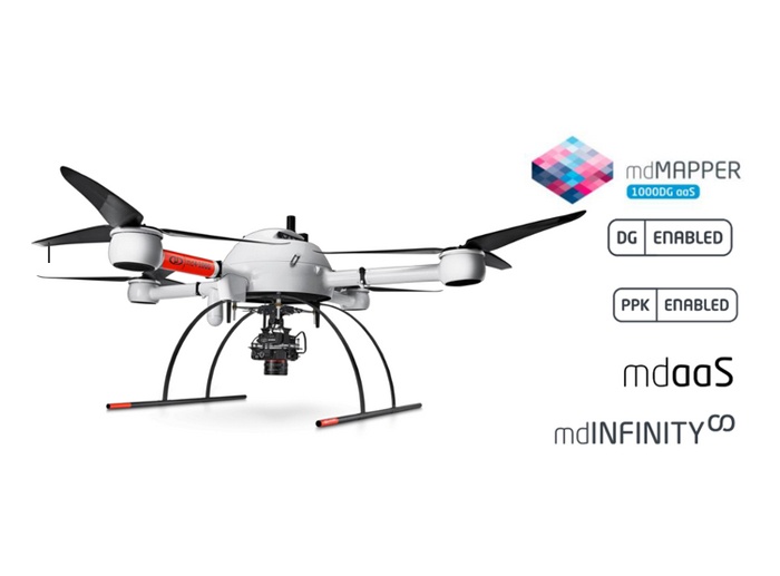
Looking for a Microdrone equipment provider in Oman? Get in touch with us to know how we can help!

