Opera Duo & U Next
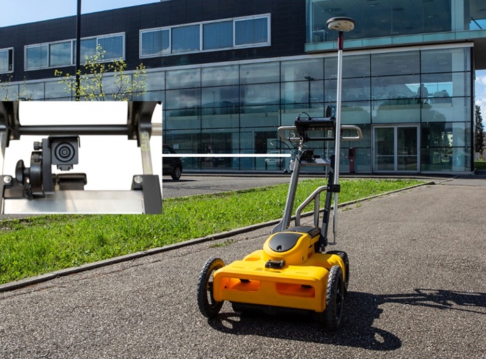
100% manufactured by utility market leader IDS GeoRadar, the Opera Duo is a compact, easy to transport and deploy Ground Penetrating Radar leveraging robustness, data quality and intuitiveness for unparalleled utility location and mapping.
Features of Opera Duo 4 Wheel Cart include:
Superior Maneuverability – A large comfortable handle to Push and Pull with large wheels for better control and a balanced weight distribution to offer minimum resistance.Robustness – Opera Duo is designed to use in any type of harsh field conditions and any type of terrain.
Data Quality – Engineered and built with Dual-Head Sensor integrating Ultra-Wide Band Antennas of Frequencies 250MHz & 700MHz offering the highest resolution and largest dynamic range for the best penetration depth.
Intuitiveness – By clicking the start button the best performance is received in all the type of soil conditions and doesn’t require to perform calibration or adjust any settings manually.
Results Delivered On Site – Opera Duo is integrated with a Software platforms for finding the position of radar and marks targets on site which can be exported to CAD or GIS, and generate the reports on site.
uNext Basic Software Platform
uNext platform offers an all-in-one, non-intrusive utility detection software solution which exploits the most advanced technologies and methodologies in the market. uNext platform is designed to operate directly on site maximizing user experience and the complete solution is fully compatible with Leica Geosystems’ DX Manager Software allowing for data storage and sharing in the cloud.uNext Basic leverages:
Any GNSS and/or TPS – Opera Duo can be interfaced to any GNSS receivers and Total Stations with the support of NEMA output and any other positioning sensors to provide the best geographical positioning of multiple utility targets in a very short time.Survey Report – Can export the survey reports including maps and targets directly in the field.
CAD/GIS – Transfer the identified targets to CAD or GIS maps for professional SUE / utility mapping.
Cartography – Imports the cartography of the surveyed area from different sources, and visualize the geo-referenced underground asset position in real time.
uNext Advanced Software Platform
The uNext Advanced platform leverages all the functionality comprised in the uNext Basic software with the additional leverages:uNext Advance leverages:
Tomography – Creates an accurate, faster 3D re-construction of the underground utility network and merge the information with an existing cartographies.
Assisted Pipe Tracker – When a pipe or cable detected then automatically the software maps the exact position of the utility over the surveyed area with which the users can benefit from more accurate, reliable data and perform data acquisitions more productively in a shorter amount of time.
Data Re-processing – Based on the on-site data acquisition and processing features, Advance Software platform enables the user to re-process the radar data for customized data visualization along with filtering capabilities.
C-Thrue
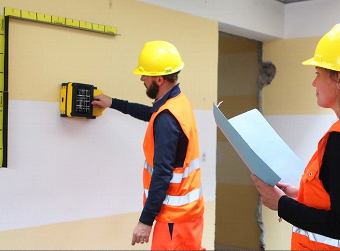
C-thrue is an all-in-one Ground Penetrating Radar (GPR) for accurate scanning and real time analysis of concrete structures through which contractors can now improve the way contractors locate rebars, voids, post-tension cables, cavities, conduits, and any other objects buried in the structure before cutting or drilling into the concrete.
Because of its robust solution, it is well suited for all construction sites and operations including building renovation, overpasses, monuments, bridges and tunnels surveys, as well as for detailed analysis of the original engineering project and comparison with the as-built structure.
Stream C features:
Massive array of 34 Antennas in Two Polarizations:
An accurate 3D reconstruction of the underground utility network in a single scan.Automatic Pipe Detection (APD):
Real-time automatic detection of buried pipes and cables.Compact Size:
Stream C’s small dimensions enable it to survey areas inaccessible to larger array systems while maintaining the same accuracy.Robust Construction:
Stream C is designed to the highest standards and robust nature which can be used in harsh and demanding environments3D Radar Tomography:
Real-time Tomography on a GPS or total station assisted Cartographic Background.Professional Sub-Surface Survey:
When data is transferred to CAD and GIS formats it quickly produces subsurface GIS based digital maps when pipes, cables and buried objects automatically.Benefits of the Stream C include:
High Productivity:
Survey need to be performed in one direction to ensure optimal detection of both longitudinal and transversal pipes.No advanced Training needed:
Stream C detects and locates the position of the pipes in real time and displays them on Screen.Facilitates Large Surveys:
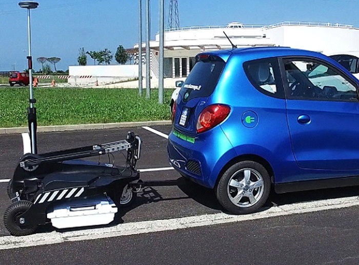
Stream C can be towed manually or with a small vehicle, increasing the acquisition speed (up to 6 km/h).Real time software for Advanced Viewing
Stream C is supplied with the One Vision and GRED HD 3D CAD software suites.One Vision
One Vision – an acquisition software for use in the field providing real-time target viewing, onsite object mapping and GPS navigation. One Vision is a software application for advanced GPR data collection.One Vision Software Platform is a powerful application for advanced surveys with integrated navigation, featuring:
Real-time tomography on a Cartographic Background (e.g. Google Maps, GeoTIFF and KML)
Multi-view screen with GPR radar maps (B-scan and T-scan), Radar Tomography (C scan) and Cartography
DSurvey Planning Tools
Special function allowing tomographic merging of transversal and longitudinal swathes
Continuous Monitoring of GPR and GPS statuses
Survey Management with interactive and on-site target mapping as well as review and editing
Automatic Pipe Detection (optional)
Increased Productivity and Reduced Costs
Immediate decision-making with real-time on-site detection
Target recognition removing the need for specialist skills
Immediate understanding of complex environments (e.g., urban areas) with the tomographic map in real time
Complete coverage is always provided in a single visit with integrated acquisition and navigation functions
Stream C
Stream C is the compact array solution for real-time 3D mapping of underground utilities and features with increased level of accuracy provided by a massive antenna array, which can detect pipes and cables automatically. Daily use of Stream C is aided by ergonomic features including electronic ride height adjustment, options to tow manually or with a small vehicle, and a motor assisted drive wheel.
Stream C is available in both Basic and Advanced configurations.
Features and Benefits:
Clearer and Faster Surveys
Detection of both first and second levels of rebars thanks to the system’s double polarization.Safe Drill in the Surveyed Structure
Rebar/void automatic insight capabilities that improve safety before cutting or drilling into the concrete.Fully-visible, Multi-touch Display
Data displayed on the screen are never obscured by the handle or the user’s hand.Simplified Data Interpretation
Optimal decision-making supported by visualizations of acquired data in 3D models.Increased data accuracy
Eliminate manual, error-prone paper grids with an automatic positioning and navigation system.Advanced data visualizations
Augmented reality for 3D data visualizations and sharing across operators – in real time or intervals after acquisition.Automated data acquisition and analysis
Automatic detection of the first layer of rebars and result exportation.Flexibility everywhere
Lightweight, compact, drop resistant and transportable system for every user operations and construction sites.C-thrue - Advanced GPR software
C-thrue with the advanced Software automatically recognizes, discriminates rebars and voids in concrete structures.C-thrue software is specifically developed and is suitable for in the field analysis:
Automatic system calibration for an easy and quick set-up and start;
Automatic recognition of rebars and voids in concrete structures;
Digital on-site representation of data and targets through Augmented Reality;
Real time visualizations of 3D radar tomography;
Capability to mark targets within the software;
Fully integrated with GRED HD post-processing software;
Ability to export full survey report.
GRED HD 3D - Advanced GPR processing and Imaging Software
GRED HD 3D is an advanced post-processing software enabling users with the following functionalities:
Radar-scan viewer, filter and advanced filtering macros;
Layer picking for automatic analysis of sub-layers;
Tomographic map view (C-Scan) including radar scan fusion;
3D data visualizations;
Advanced targeting using radar-scan and tomographic view.
Opera Duo & U Next
- 100% manufactured by utility market leader IDS GeoRadar, the Opera Duo is a compact,,...
C-Thrue
- C-thrue is an all-in-one Ground Penetrating Radar (GPR) for accurate scanning and ...
Stream C
- Stream C is the compact array solution for real-time 3D mapping of underground,...


